
All work

Robopoint

An automation system developed around calibrated cameras, positioning and photogrammetry.

Year2012–2017
Made withPanoramicWEB · TÜBİTAK-supported R&D
FieldHardware & R&D
StatusDelivered
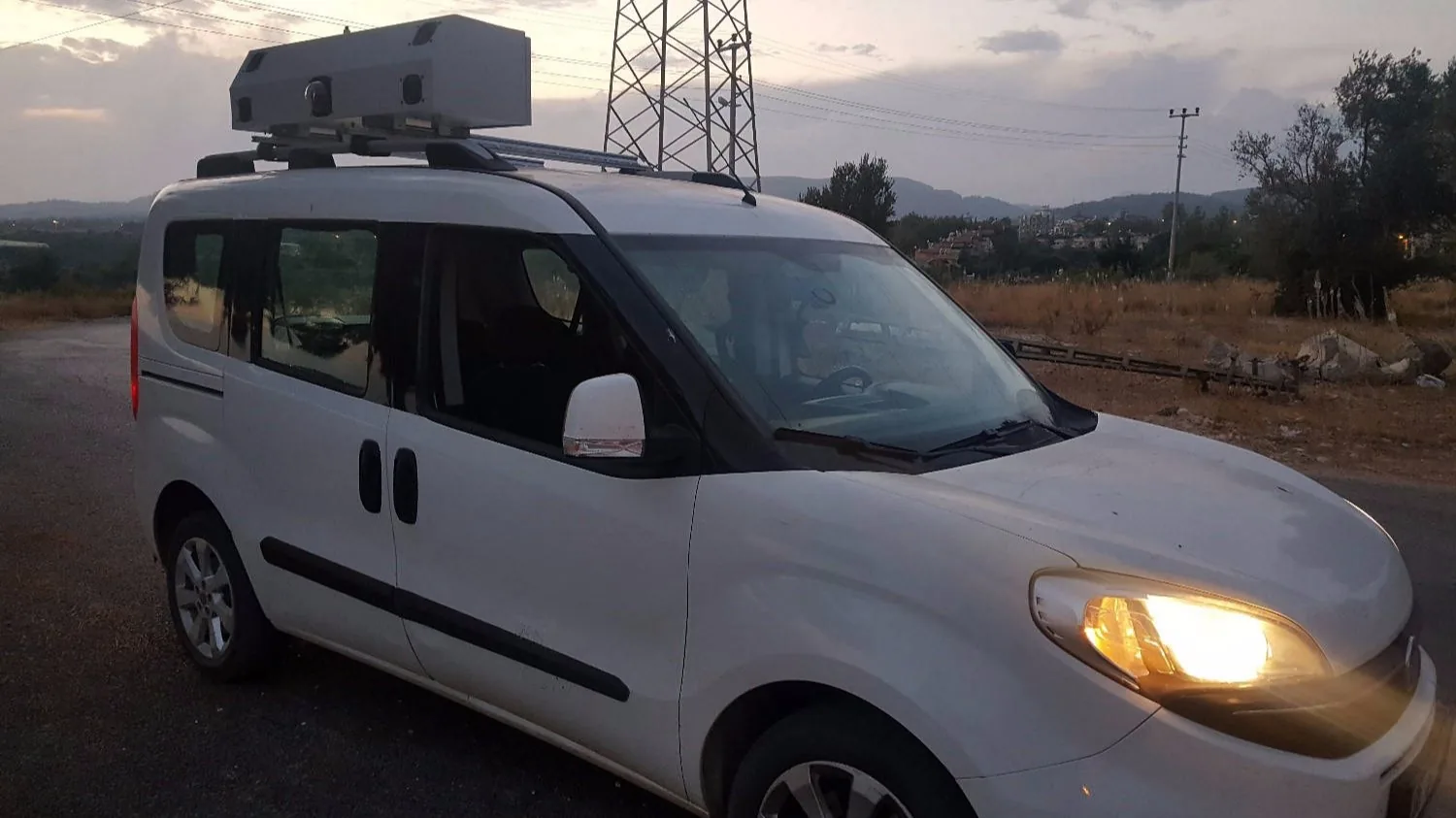
The Robopoint mapping vehicle fitted with a multi-camera system.

The system behind the experience.

Technology atlas
2012—2017 / POINTCLOUD

Robopoint / Photogrammetry

Robopoint links coordinated camera control with IMU and GNSS/RTK data. Captured images enter a photogrammetric workflow that produces a point cloud. The product archive lists compatibility with Aurvis, Bundler and Agisoft.

Robopoint technical archive
2012 / THE PROJECT STORY

The measurement behind the photograph.

Back then

Manually processing image position, orientation and distance created time and consistency problems in large capture projects.

What we made

We developed Robopoint to connect IMU, GNSS/RTK and calibrated cameras with control software, making the workflow from capture to point cloud more structured and repeatable.

What it made possible

Recorded as a 2012–2017 TÜBİTAK R&D project, the system is part of our approach to making our own imaging tools.

2012–17R&D period
RTK + IMUPosition and orientation
PhotogrammetryCalibrated camerasGNSS / RTKIMU
Sources and archive
Have something like this in mind?