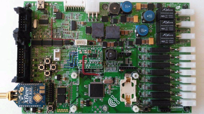
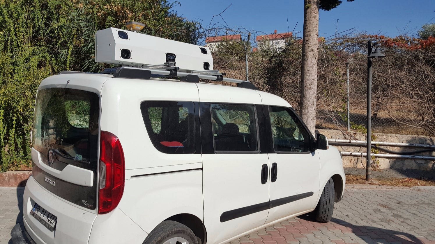
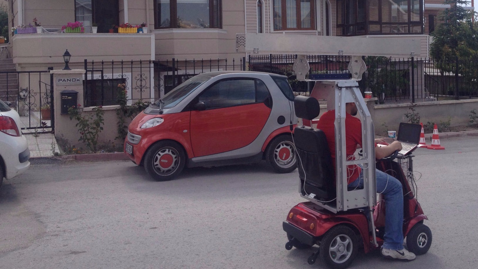
ROBOPOINT

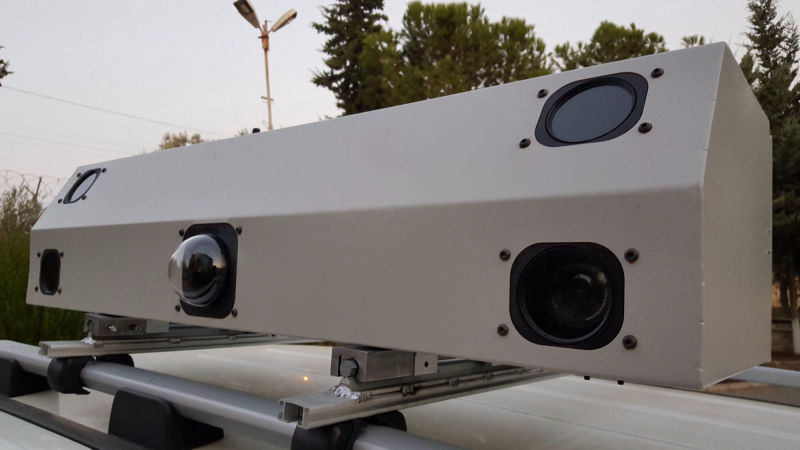
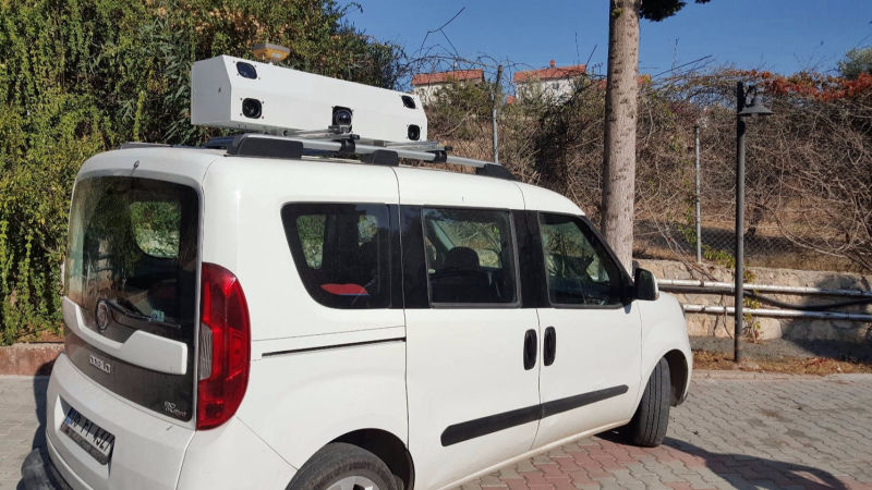
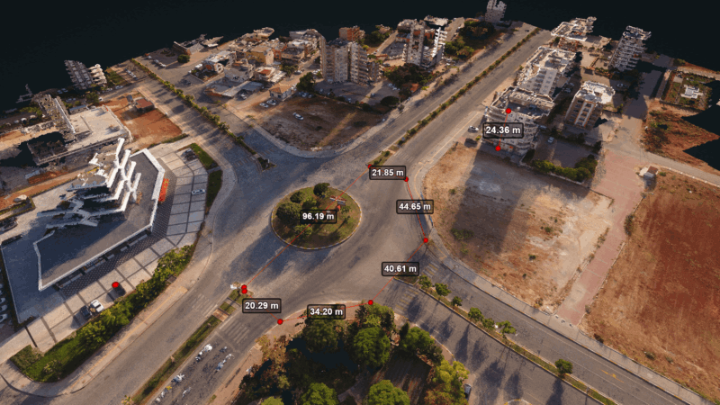
HIGH ACCURACY POSITIONING FOR PHOTOGRAMETRY
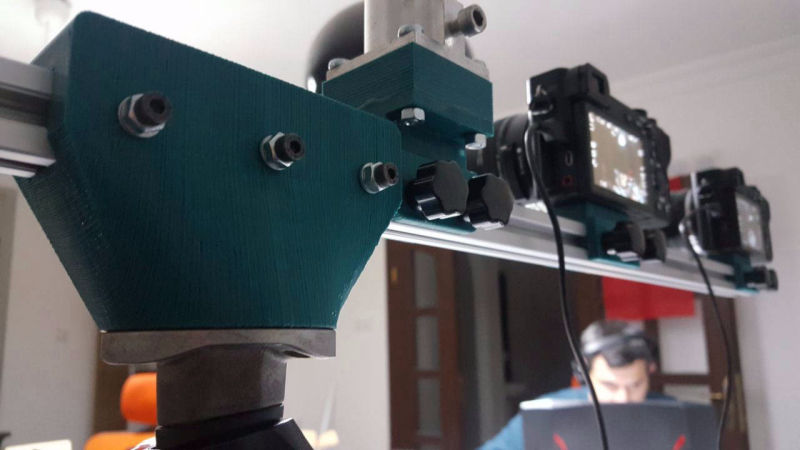
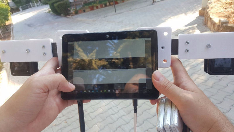
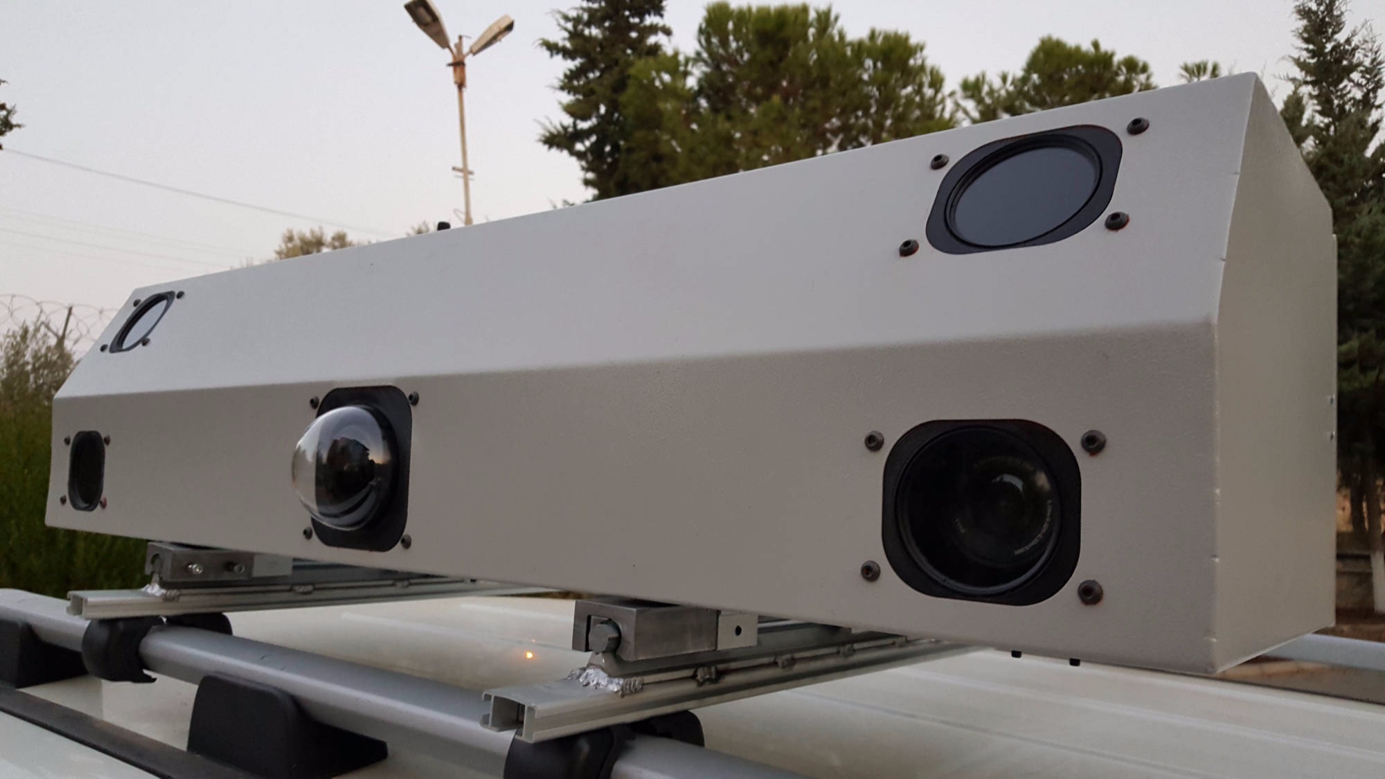
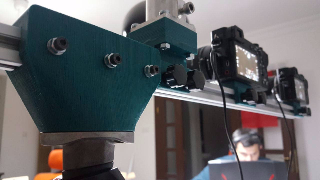
MULTIPLE CALIBRATED CAMERAS CONTROL SOLUTION
TUBITAK R&D PROJECT 2012 - 2017

WHAT IS BEHIND OF THIS IDEA?

  • Using the position, direction, distance and slope information of the created panoramic photographs, transitions between them is provided and virtual reality experience is enhanced and virtual navigation systems are created. This information is currently determined and used by manual methods. For this reason, errors in large proportions and loss of time are observed.
  • Equipped with sophisticated algorithms written in a variety of software and supporting hardware through ROBOPOINT Photogrametry Automation System, starting with the photo shooting till the final stage which is the point cloud application, determining and recording operations such as photo merging, position, direction, distance, slope information are done automatically. In this way, the manufacturing process is reduced to the minimum levels.
  • To carry out this system, some devices are used such as an integrated IMU and GNSS unit that contains Gyroscope, Compass, RTK GPS, Accelerometer and Encoder.
  • For transitions between photogrametric images, entering the position, direction and distance information manually and updating the system makes the merging process longer. In addition, making these procedures manually increases the likelihood of an error.

WHAT ROBOPOINT CAN DO?

Robotic system developed by own R&D with financial support of TUBITAK creates VR photos with Geographic Information System data, high speed and accuracy in shooting process and increse cost efficiency.

With the help of the shooting robot and office work, we are transforming the geographical information system based photographs into the Point Cloud in a short time

It is Compatible with Photogrametry Softwares (Aurvis, Bundler, Agisoft)

PANO-X BOT TECHNICAL DETAILS

rtkgps imu
1

IMU

We have IMU unit powered by our algorythms  to combine positioning datas from Gyroscope to level image, Compass to get looking point of camera

2

RTK GPS

We have RTK based GPS solution inside Pano-X BOT,  Rover based system integrated to panoramic bot and connect to RTK GNSS server from internet or 1-5km with RF to base station that named PANO-X Basestation

3

MULTIPLE CALIBRATED CAMERAS

This solutions make low noise data in photogrametric pointcloud output solution. Calibrated  cameras gives  only take single shot that can make measurement  from positioned high resolution cameras 

© Copyright 2019 PanoramicWEB - All Rights Reserved